Implementing the Louisiana Purchase – Jacob F. Lee

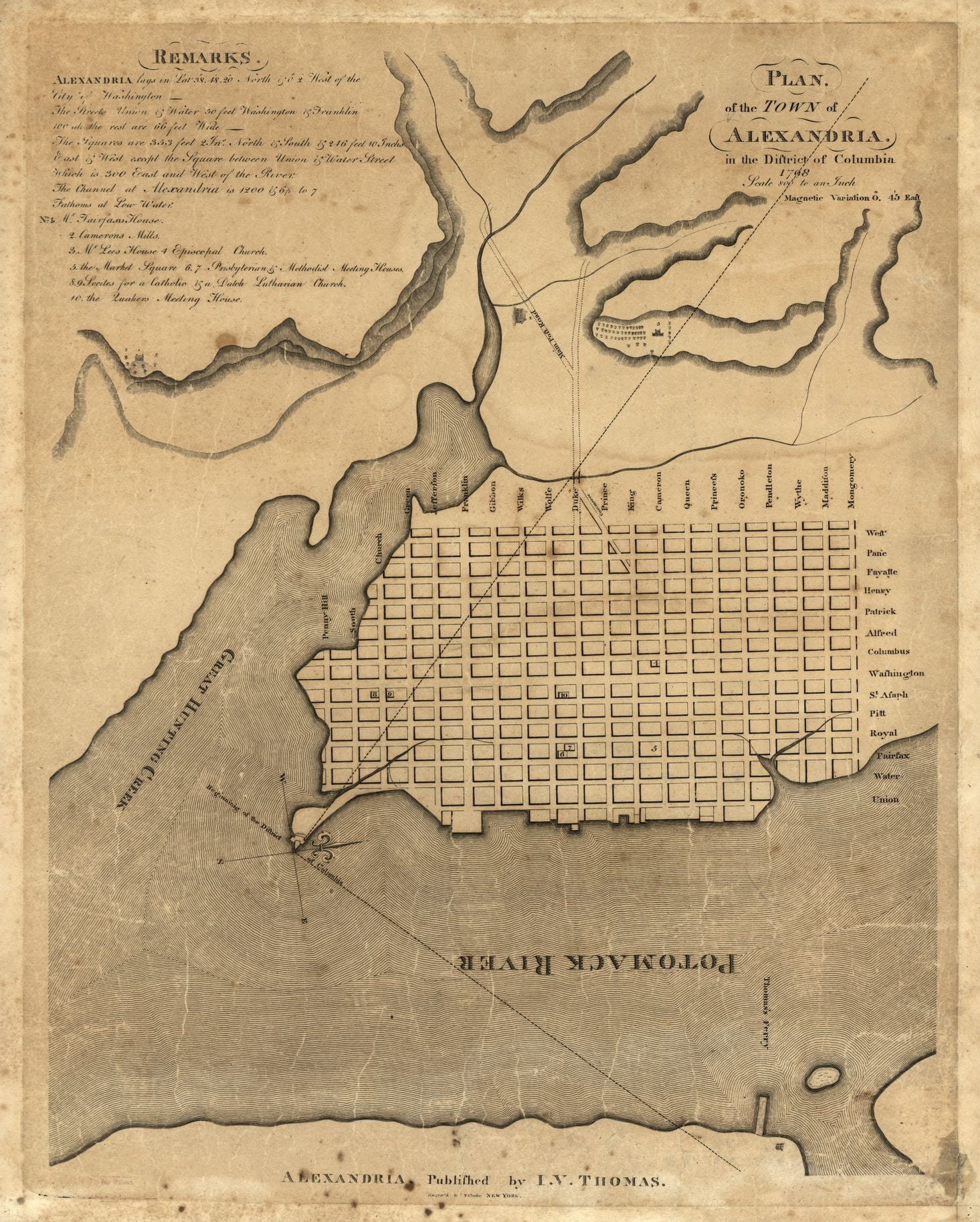
Being surprised is one of the great pleasures of historical research. As little as a passing reference in a single document can spark new understandings of a person, event, or era. In 2019, I began research on a book project about the long aftermath of the Louisiana Purchase and the United States’ century-long project of colonizing the vast lands it had ostensibly acquired from France in 1803. Early on, I…

What is an Early American Treaty? – Rachel B. Herrmann

In the summer of 2011, I was in the National Archives in Kew, London, to read papers in the Sierra Leone Original Correspondence collection. I was researching a dissertation that became a book about hunger and the American Revolution, when I did something that most historians have done.1 I read a document that was peripherally related to my research, recorded some initial observations, and moved on because I didn’t know…

The Grand Strand: Returning to the Early American Coast – Daniel Walden

Managing the effects of climate change on the world’s coastlines is one of the primary environmental challenges of the next one hundred years. Warming global temperatures and the subsequent melting polar ice will have significant physical, economic, and social impacts in some of the globe’s most densely populated areas. In the United States, more than 39 percent of the total population lives in coastal areas that comprise less than 10…

Accounting for Life: Letterbooks, Ledgers, and the Life of Alexander Wilson – Philip Mogen

It was an August day in 1768 that the young Scotsman Alexander “Sandie” Wilson was told he would be traveling to Virginia. He had been outside with friends when he was called into his Glasgow home, sat down, and informed of the situation. “Well Sandie,” his father told him, “you must go over seas.” Several months earlier, while discussing his future, Sandie had told his father that he “wou’d like…

Quassaquanch’s and Shaumpishuh’s 1639 Map of the Connecticut Coast – Nathan Braccio

In 1639, two Algonquian sachems (leaders), Shaumpishuh and her uncle Quassaquanch of Kuttawo and Totoket, met with a few English colonists and created a map of the Connecticut shoreline that would become a site of cultural contest. This artifact is a rare example of an Indigenous map from New England–despite an Algonquian tradition of cartography. Although most of the surviving Algonquian-produced maps come from later in the 1600s, this one…