
In the 2021 season, the Lagash Archaeological Project began using a new sUAS/drone system for precision aerial mapping. The drone, itself, is a DJI Phantom 4 RTK, which when used with the accompanying base station yields accuracy of about 1.5cm horizontally and 2cm vertically.
A flight plan was created using DroneDeploy and transferred onto the drone controller’s built-in tablet with a custom-built python script and conversion to KML format with QGIS. The built-in tablet, unfortunately, is not yet capable of running the DroneDeploy app, so once the flight plan was uploaded onto it, the other flight parameters (speed, elevation, overlap, etc.) were adjusted to match those in the DroneDeploy original.
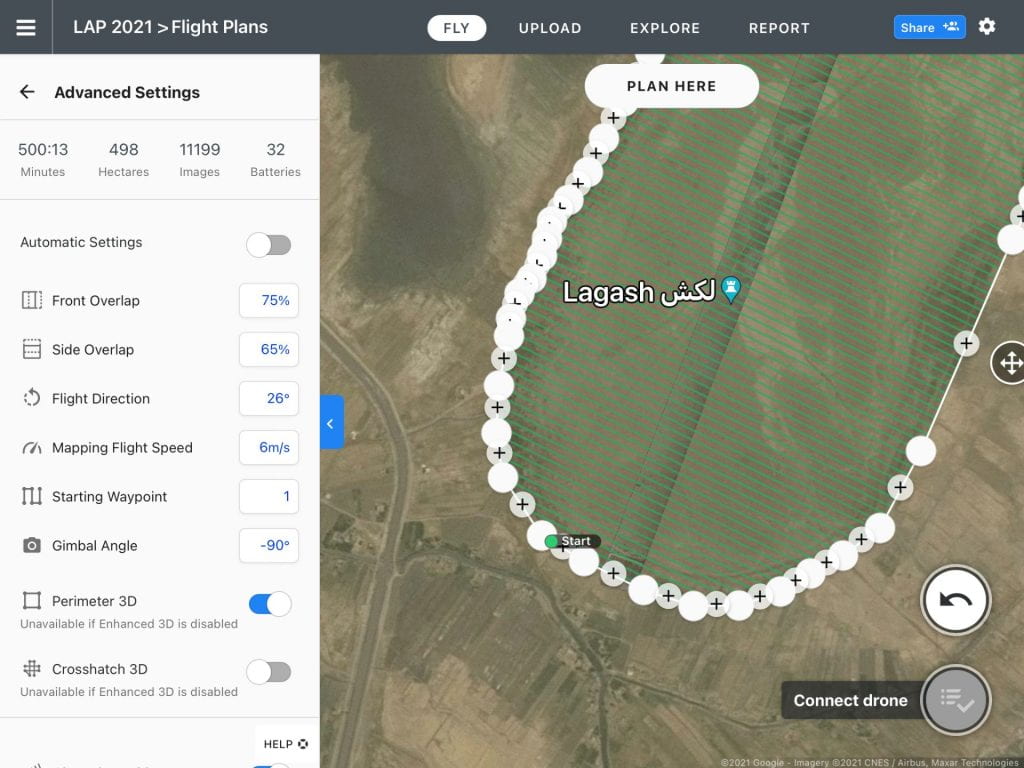
Detail of the DroneDeploy flight plan.
The drone flights, themselves, were carried out in a series of morning and afternoon sessions across five days. Each two-hour session used four aircraft batteries, and the lunchtime break provided the opportunity to swap the batteries in the controller and the base station with fully-charged ones. With eight aircraft batteries total, this schedule kept us in steady supply of fresh batteries and gave us a much-needed break from staring into the bright Iraqi sky. A final flight plan was also flown longitudinally (roughly N–S) across the site for additional elevation control.
Over 12,000 photographs were taken across the site’s 500 hectares. Each session was subsequently uploaded to DroneDeploy to be stitched into orthomosaics and elevation models. now that this process is complete, those images have been downloaded again to the site GIS for smoothing and corrections in order to create a new and highly-accurate contour map of the entire site.

DroneDeploy elevation model of the first flight session. Red indicates the highest points on the mound and the lowest points in the canal are indigo.