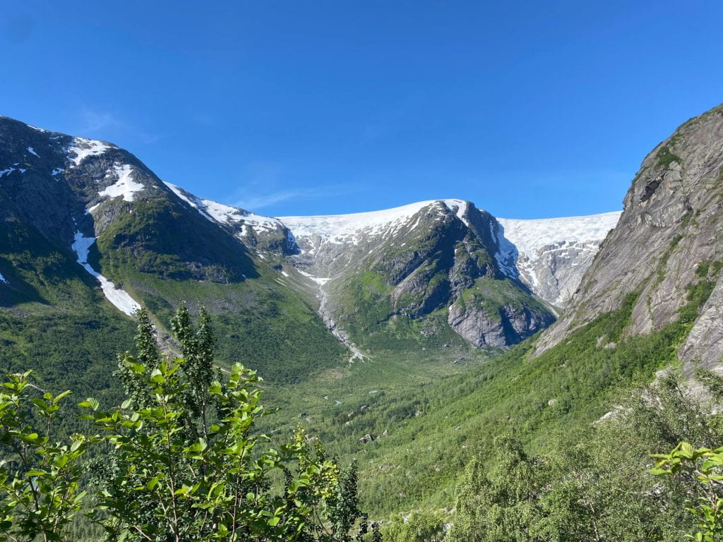
 Our team partnered with members from the University of Bristol and the Arctic University of Norway (UiT), located in Tromsø, to travel to Jostedalsbreen National Park. The park is located in the southern part of Norway and is home to eleven glaciers. Today, the glaciers encompass the largest ice cap in mainland Europe. The glaciers make up nearly half of the national park’s surface area, otherwise classified by its dense forest and fast-flowing emerald green meltwater.
As a result of climate change, the glacial meltwater scrubs against the bedrock beneath the ice and creates fine-grained sediment, characterized as glacial flour. This glacial flour is washed away with meltwater and ends up in glacial-fed rivers, lakes, and the fjord. This glacial flour reflects light in such a way to develop this vibrant green color across the national park. The color is beautiful to the eyes, but the glacial flour may have geochemical impacts on the surrounding ecosystem.
 The fjord, fed by Jostedalsbreen National Park’s glaciers, is the longest fjord in Norway, as well as one of the longest fjords in the world. Currently, there is a ban on consuming the fish in the inner fjord of southern Norway because previous research has found an unhealthy amount of mercury in their blood. Noticing this health risk, our team sought to understand the biogeochemical range of the ecosystem. As a result of glacial flour mobilization and increased glacial recession, we looked at a mixture of non-saline glacial meltwaters to saline waters in the fjord to understand how glacial meltwater may contribute to increased trace metals, increased mercury, and increased nutrient concentrations in the downstream ecosystem.
 Our team climbed the glacially scoured mountain sides to various glaciers located in the park, including Nigardsbreen, Fåbergstølsbreen, Tuftebreen, and Tunsbergdalsbreen. We collected and filtered glacial meltwater directly below each glacial portal to measure the major ions, mercury concentrations, trace metal concentrations, dissolved organic matter composition, and suspended sediment concentrations and composition. Using the same sampling methods, we then sampled five points across the central river transect, the Jostedøla River. The Jostedøla River is fed by the ice cap that covers most of Jostedalsbreen National Park, including the glaciers our team sampled. The river exits the terrestrial ecosystem and enters the fjord next to the town of Gaupne, Norway. To understand the biogeochemical range of the mixing zone, where non-saline waters mix with saline waters, we sampled across the inner fjord, ranging from Skjolden, Norway, to Kaupanger, Norway. The Jostedøla River enters the fjord in between these two points.
Our team is interested in the geochemical impacts of glacial recession. With mercury concentrations found in unhealthy amounts in the inner fjord fish, we hypothesize that this element may come from the weathering bedrock underneath the ice cap in Jostedalsbreen National Park. Understanding how trace metal concentrations and toxic elements are mobilized due to increased glacial recession will become increasingly important as the climate changes. Furthermore, understanding the biogeochemical range of these elements and how their concentrations change as they move farther downstream will allow us to comprehend the overall impact on the entire ecosystem. Stay tuned for more information coming this year on our Norway field research trip results.

