Current Excavations
Season 3: 2022
Introduction
The third season of excavations at the site of Tell al-Hiba, ancient Lagash, ran from March 6 -April 10, 2022, led by Holly Pittman (University of Pennsylvania) with co-field directors Augusta McMahon (University of Cambridge) and Sara Pizzimenti (University of Pisa). Work continued to focus on occupational density and craft production in Area H. Methods combined excavation, surface survey, UAV and thermal drone photography, photogrammetry and mapping, as well as, coring for geological and cultural sediment samples.


Arrival March 5, 2022

Our New House in the Village of Al Hiba

Lagash from the air

View from the roof toward the site
Excavation
Areas of exploration of the site of Lagash
Area B—Bagara of Ningirsu
Area C—administrative complex of ED III B
Area G—administrative complex of ED I
Area H—Craft production and domestic architecture

Excavation in Area H
Excavation continued to explore the relationship between the ceramic kilns uncovered in 2019 season in Trench 1 and architecture and urban features visible through radio magnetometry and drone photography.
Three 10 x 10 meter trenches were opened to the south of Trench 1: Trench 4; Trench 2 and Trench 3 descending on the mild slope. Trench 4 was placed to investigate the east-west street visible in the magnetometry; Trench 3 was positioned to investigate the small alley, and Trench 2 was situated between them in an area showing industrial burning.
")
The latest the period of the kilns was revealed in Trenches 1 and 2. In Trench 4 an ephermal phase contemporary with the kilns was articulated in the east. In Trench 2, three kilns were uncovered in the higher eastern area of the trench, also associated with ephermal working surfaces.
In both trenches, a phase earlier than the kilns was also revealed. In Trench 4 a wide street was exposed while in Trench 2 well defined architecture was revealed.
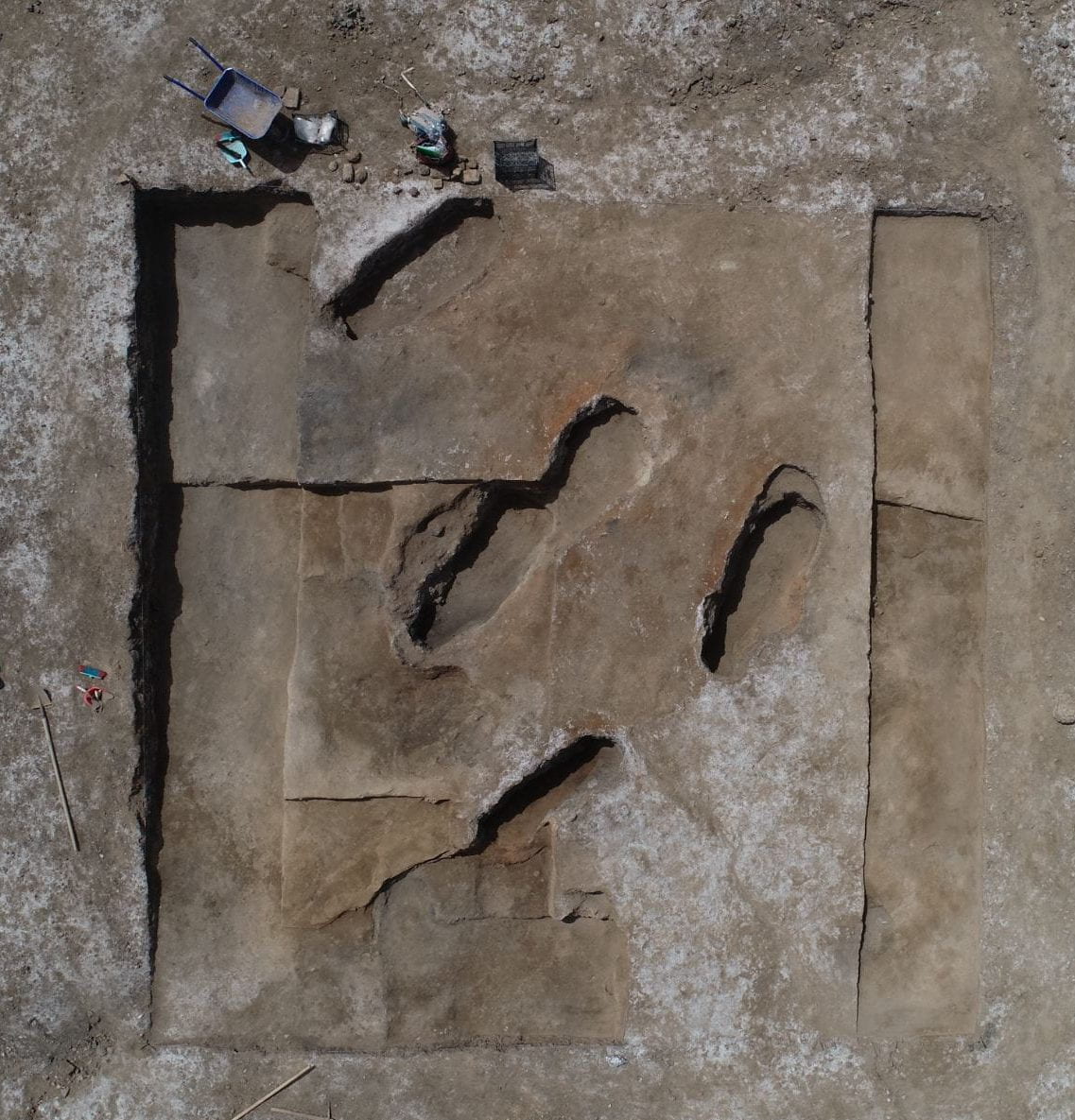

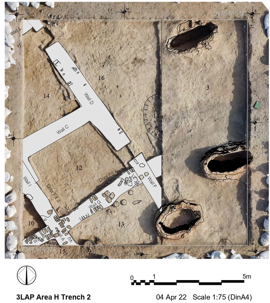
The earlier phase is more clearly articulated in Trench 3 which is at a slightly lower elevation. In Trench 3, four subphases were defined through the presence of floors and the rebuilding of walls.
Recording in all of the trenches was augmented by daily photogrammetry to allow for the digital creation of 3D reconstructions and sections.
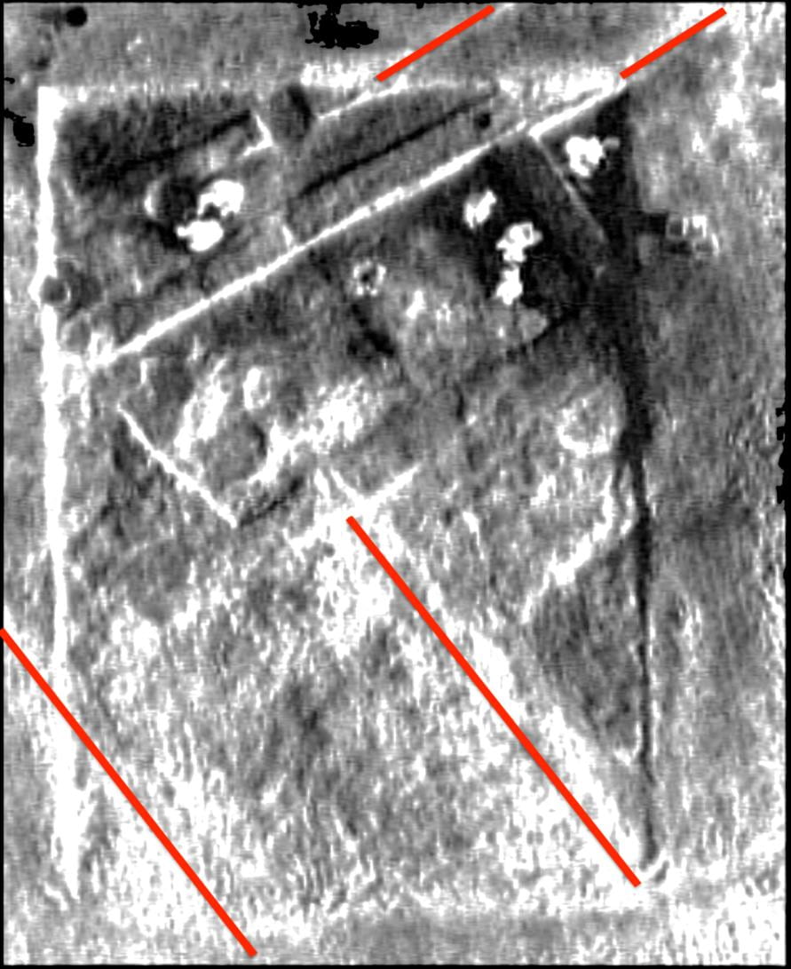
Thermal drone photography was also used to reveal features close to the surface.

Test Trench X
A 2x2m trench was excavated to a depth of 1.2 m to determine if the low mound to the east of the main mound was archaeological. Only one pottery sherd was found which was judged to be intrusive. The mound is not archaeological but was likely formed by the progression and regression of an adjacent seasonal marsh.
Uruk Mound
Just south of Test Trench X another small mound was investigated through informal survey. On the surface were abundant fragments of beveled rim bowls, strap handles and twisted handles diagnostic of the Middle Uruk period. This is the first time that Uruk levels have been detected on the surface of the site.


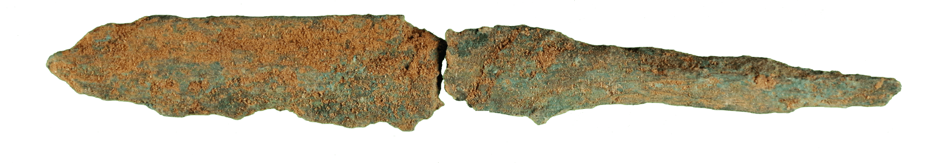
Material Culture
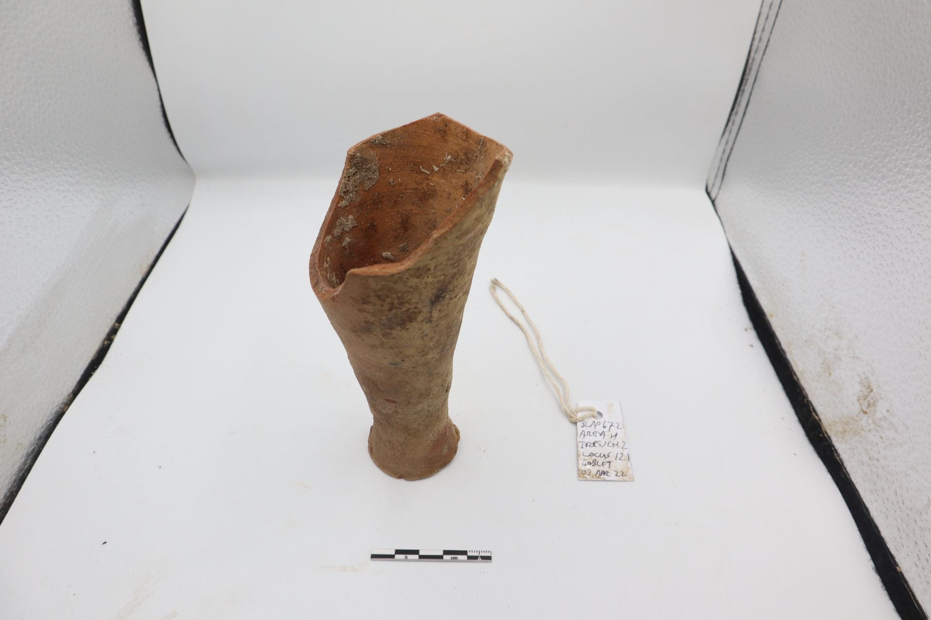
Predictably, pottery was by far the most abundant artifact type collected both through survey and excavation. It was systematically processed following protocols developed during the 2019 season by Sara Pizzimenti. This season she was supported in the ceramic processing by two graduate students from the University of Pisa, Sara Quaggio and Gaia Zuccoli. The upper surfaces of the trenches in Area H produced pottery typical of the ED IIIA phase.
It was surprising that the date of structures excavated in Area H beneath the level of the kilns is not ED IIIA. The pottery found in these lower levels is typical of the earlier ED I phase with the frequent appearance of solid footed goblets.


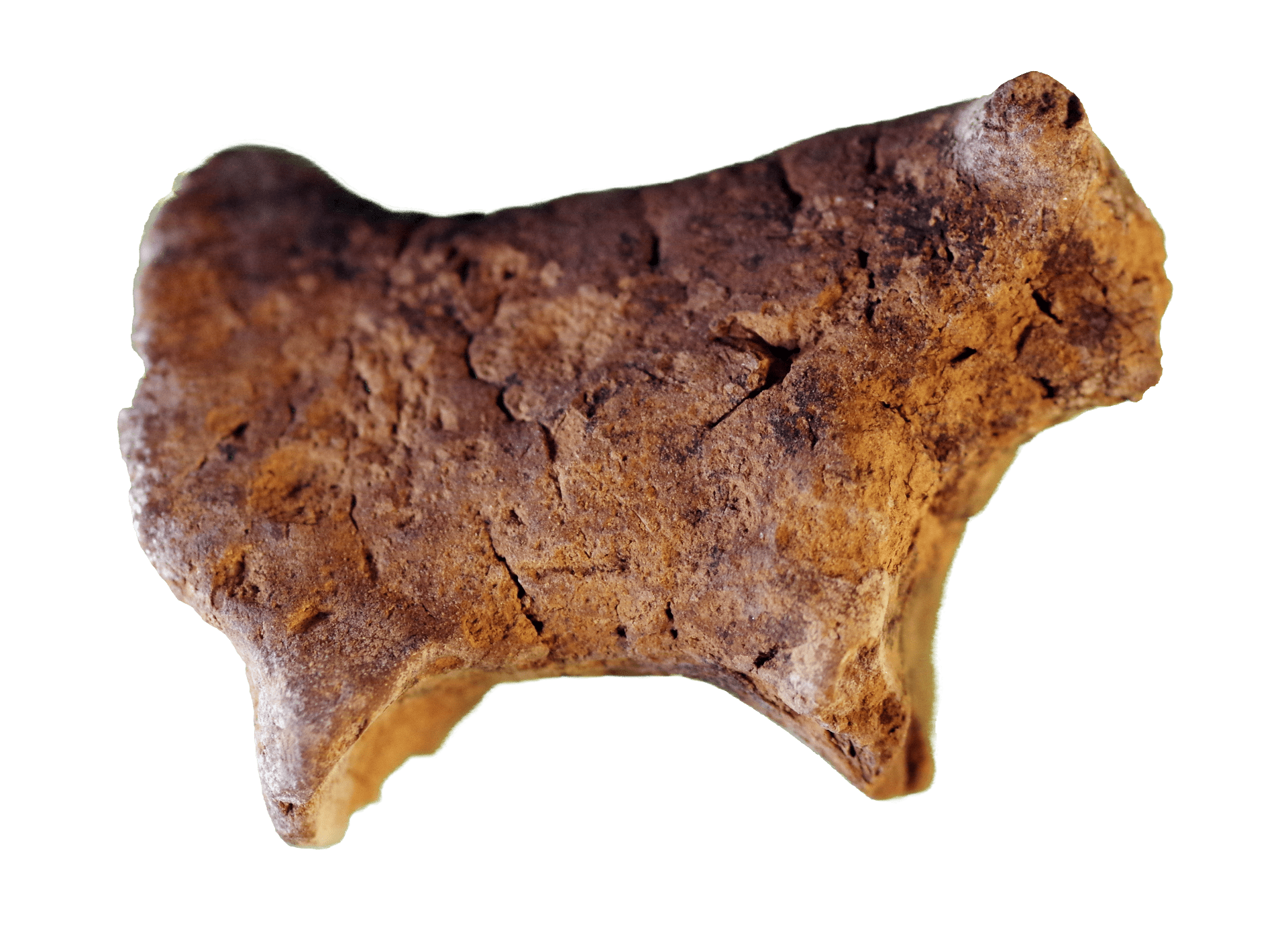
Small clay animal figurines were found associated with the kilns, and may be trash redeposited from earlier contexts together with the sealings. The same associated artifacts were found In 2019 in Trench 1 of Area H.
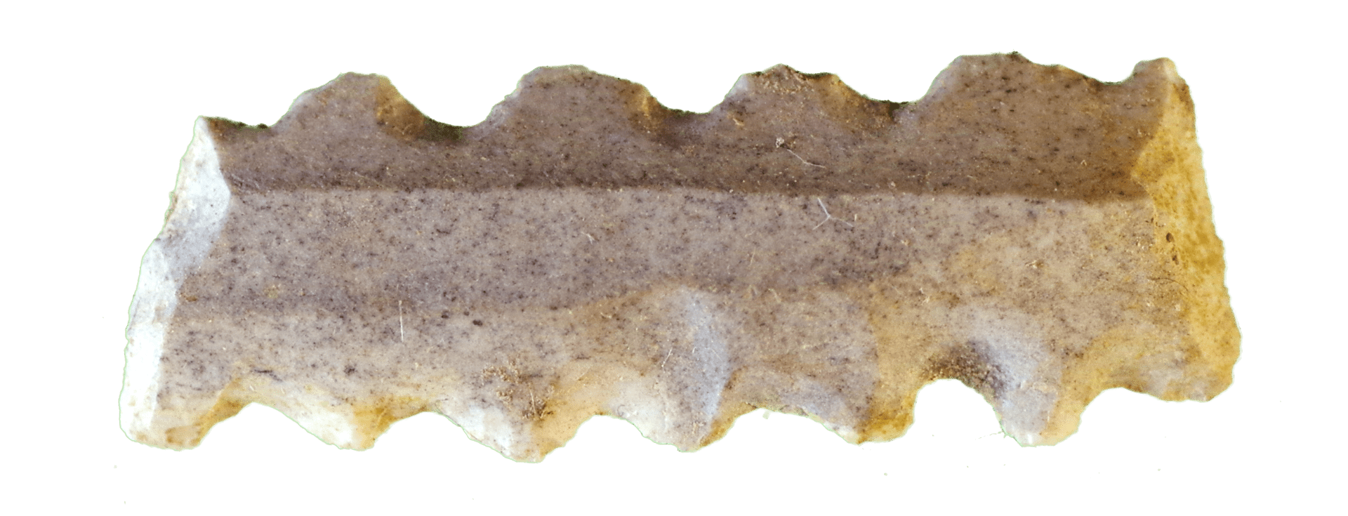
A curious artifact type found in considerable numbers are clay rings, either flat or circular in section. These artifacts were usually unfired, and have no clear patterns of use. As with the other artifacts, most were associated with the kilns areas.


Photogrammetry and Survey

Paul Zimmerman in the field
Site-Level sUAS Photogrammetry
The same sUAS (drone) system employed in 2021 to generate a new topographic plan of al-Hiba/Lagash was used to generate enhanced photogrammetric imagery of selected regions of the main tell as well as a number of outlying sites. A DJI Phantom 4 RTK drone was flown on pre-planned routes at 100m elevation, capturing hundreds of photos on each route which were then uploaded to the online service Dronedeploy for the creation of georectified orthomosaics and DTMs.
Zimmerman flew regularly when the wind would allow, concentrating in several parts of the mound, including around Area C, where a wall surrounding a large neighborhood can be clearly seen both in the UAV photography and on the ground.
Lagash Area H and the City Gate
Routes over Area H and the southeast edge of the site where a main city gate had been previously identified were flown on multiple occasions, taking advantage of differing weather conditions and sunlight to reveal subsurface architecture. The orthomosaics thus created were then imported into AutoCAD by Marc Marin Webb who continues to identify and trace subsurface architecture on a city-wide scale.
Lagash Area C and Its Surroundings
A route was flown over Area C (excavated in the 1968–1990 project) to document prior work and to plan potential future work in this part of the site. Upon inspecting the orthomosaic of that flight, new traces of a massive wall enclosing the entire district were revealed. Subsequently, two more missions were flown to the north and south of Area C in hopes of revealing the full extent of the enclosure wall.


Systematic Surface Survey
Paul Zimmerman developed a new system for pedestrian surface survey of the site. Target locations were pre-plotted in GIS and loaded into ArcGIS Field Maps on three GPS-enabled Apple iPads. In the field, each surveyor used an iPad to locate themselves on the nodes of a 50m grid and then collected all the objects on the surface in a 1m radius circle of each point.

The data collection in ArcGIS Field Maps was made bilingual in English and Arabic. Data collection was performed by Dr. Zaid Alrawi, Baqir Azab, and Dr. Paul Zimmerman, with the bulk of the survey conducted by Haidar Saad and Abdul Khaleq Jassim. This survey complements and expands the surveys undertaken by Elizabeth Carter in 1984 and the one designed by Emily Hammer in 2019.


Processing the survey finds at the house


Geoarchaeology
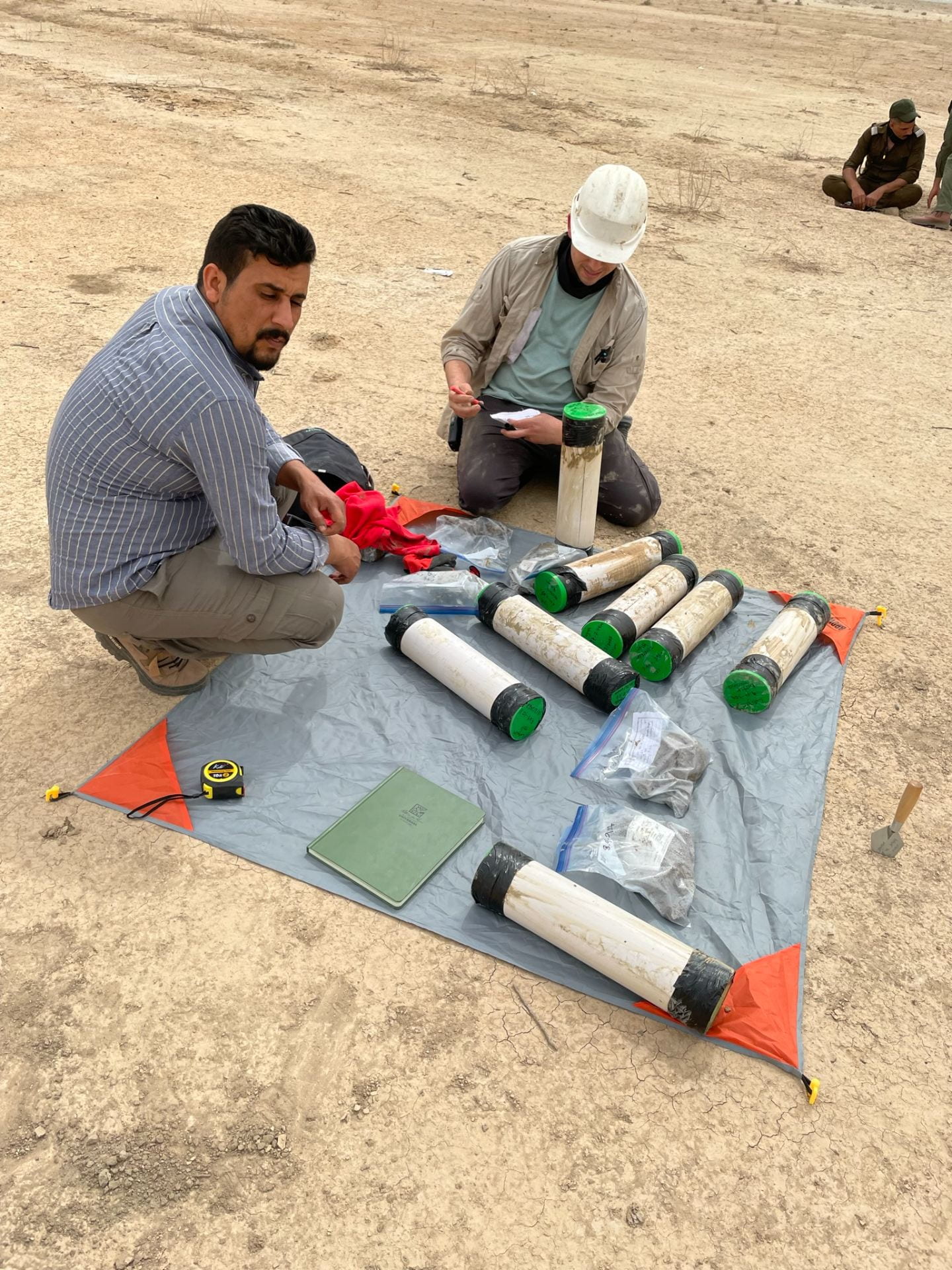
Geological Coring
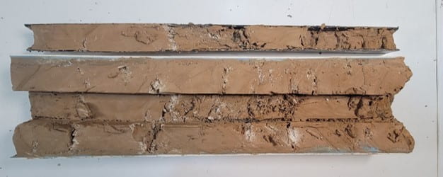
Reed Goodman oversaw geological coring at the site. RSK Environment (based in Basra, Iraq) was contracted to extract a geoarchaeological sediment core in a low-lying depression, free of cultural material, in a northeast section of the site (31.42131, 46.41921). This work was planned and executed to complement geoarchaeological work from previous seasons. While earlier work captured various depths of Holocene date, this season’s deep core reached Pleistocene strata, allowing us to anchor previous datasets and create an unbroken record of ecological changing stretching back some 20,000 years.

A percussion drilling rig, operated by four expert drilling technicians reached 25-meters depth (c. 20-meters below sea level) over the course of 4-days, completing work on March 10, 2022.


Samples were recovered as intact strata in bore pipes and as bulk collection in secured bags. Sediment samples were photographed and described in the dig house laboratory. Subsamples of important facies were sieved and analysed under microscope for Forams.
A further subset of samples was exported in mid April to the Woods Hole Oceanographic Institution in Woods Hole, Massachusetts, USA for a range of in-depth analyses, including texture, bulk geochemistry through X-Ray fluorescence, isotopic studies, and detrital zircon geochronology to characterize and date Lagash’s ancient environment, trace river networks (Tigris versus Euphrates), and to interpret findings against Mesopotamian culture history. Organic inclusions of charcoal and shell will be radiocarbon dated to enable chronological comparison of sedimentary sequences between this and prior cores and to interpret these results against previously published geoarchaeological studies in Iraq.

Reed Goodman and the “flame sealing” of the First Lagash sample for radiocarbon. At NOSAMS laboratory at WHOI June 2022
In addition, Goodman sampled a drain (Drain 10) in Area H Trench 3 by hand auger down to a depth of 5-meters. We hypothesize that this feature represents an ancient toilet. Dr. Augusta McMahon and colleagues at the University of Cambridge will conduct a microscopic pilot study or parasite eggs recovered in the sediment removed from this drain to characterize disease vector/load and its change through time, and thereby establish a proxy of household health in an urban Early Dynastic residential context.
