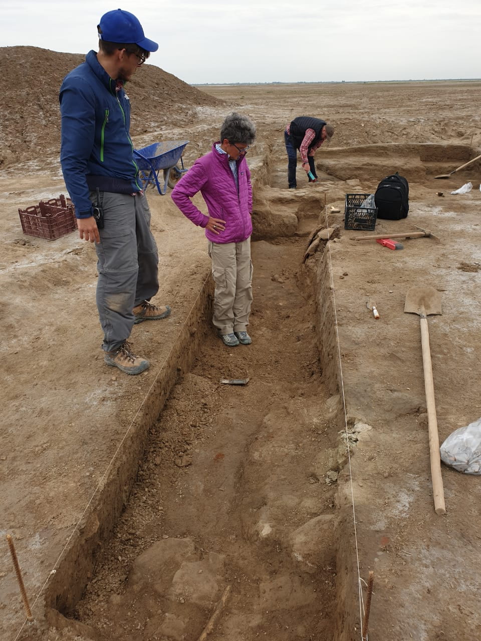
Current Excavations
Season 1: 2019


Lagash Archaeological Project: Joint Penn Museum-Cambridge University Campaign
The Penn Museum and Cambridge University joint project is led by Prof. Holly Pittman, Director and Permit Holder and Prof. Augusta McMahon, Field Director. The team has developed a five-year research agenda to investigate the unique environmental, social, political and economic processes that allowed these first cities to emerge in southern Mesopotamia. Central to this campaign are the application of an array of new techniques including drone photography, gradient magnetometry, and geological coring as well as biological and genetic analysis. In the first season, drone photography revealed dense urban architecture over much of the mound; gradient magnetometry revealed a massive city wall, a gate and zones of domestic architecture which will be the focus of future excavations. Because the site was largely abandoned around 2300 BCE, archaeological remains for the period of first urbanization are easily accessible on the surface. In the third millennium, much of southern Mesopotamia was marshy delta at the mouth of the Persian Gulf. Coring for geological sediment across the site and its edges is establishing for the first time the importance of marshes with their unique resources in the emergence of first cities.
The first season of renewed archaeological research at the site of al-Hiba took place from mid-March through the end of April 2019. Our research at Lagash examines the occupational density and use of this very large and important Early Dynastic period city and explores the nature of its surrounding environment and resources. Our research methods comprise excavation, surface survey and materials collection, drone photography and mapping, magnetic radiometry and geological coring.
Excavation
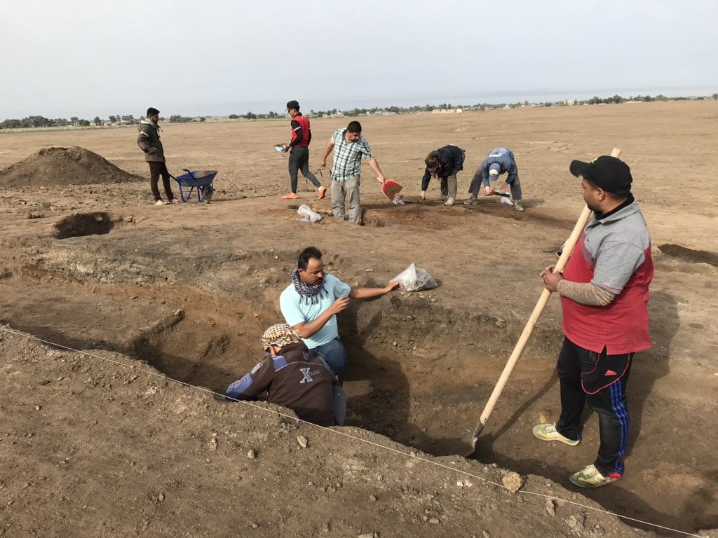
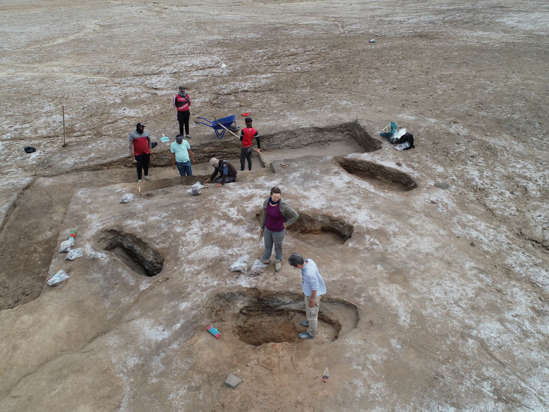
Area G
A former excavation area of the Metropolitan Museum-New York University project located at the western edge of the site. The earlier excavations uncovered parts of an Early Dynastic I Period building. The presence of numerous cylinder seal impressions suggest that it had an administrative function. Our goal for area G during the 2019 season was to make a stratigraphic connection between the earlier work and to clarify the curving exterior wall of the building complex to the east. The excavations of this area were supervised by Dr. Darren Ashby. The trench is ca. 20 m long and 5 m wide. Walls first exposed by the NYU project at either end, although very eroded, were defined.
Excavations concentrated on the eastern end of the connecting trench, where at least two sub-phases of occupation and rebuilding were identified. The eastern wall had been rebuilt several times, each phase associated with an ashy floor and flat lying pottery. As expected, the pottery from this operation is dominated by solid footed goblets, tall beakers, and conical bowls. One large sherd from a Scarlet Ware jar had plant and animal figures and confirms the early dating.
Area H
Area H is in the central-southern portion of the site, in a zone of low, discontinuous mounding. Augusta McMahon selected this area for new excavations because the surface is ashy and covered with pottery slag and sherd wasters, suggesting it was an industrial area for pottery manufacture. Our knowledge of industrial practices in ancient Mesopotamia during the Early Dynastic Period is very limited, in contrast to our greater knowledge of palaces, temples, and houses.
 McMahon opened a 10 x 10 m trench on the highest of the small sub-mounds. After initial cleaning and collection of the surface materials, four large patches of ash and red-brown burned soil were clearly visible. When investigated, these ashy patches proved to be the fuel or fire pits of four kilns all having the same NE-SW orientation. They are essentially contemporary, belonging to a single-phase.
The fire pits are roughly 2 m long and 70 cm to 1 m wide and preserved 50-70 cm deep. They were constructed with a long oval pit with walls lined with plano-convex mudbricks, baked bricks and clay. Although the kilns’ upper portions were not preserved, McMahon thinks that they were probably domed structures of mudbrick and clay. The fill in the fire pit consisted of upper layers of fallen kiln roof and deeper layers of burned white, pink, and red soil below, mixed with lenses of ash. Overfired greenish warped pottery wasters and hard lumps of shiny green slag are common.
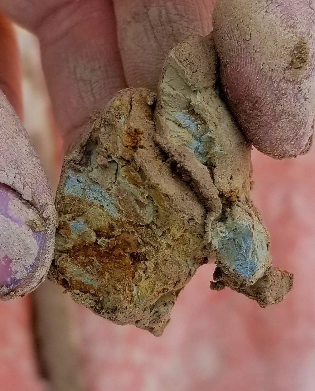
Two of the upper kilns contained fragments of animal figurines, and one had large amounts of burned sealing clay, including approximately ten container sealings with partial cylinder seal impressions and many more fragments with impressions from containers or fingers. The seal motifs find their closest comparisons at Ur’s SIS strata and those from the previous excavations in Area G. The most frequent pottery forms recovered from the kilns were tall beakers and conical bowls dating to the mid-late Early Dynastic I Period. The kilns may be slightly later than the use of the building in Area G, as solid-footed goblets do not appear here.
Remote Sensing
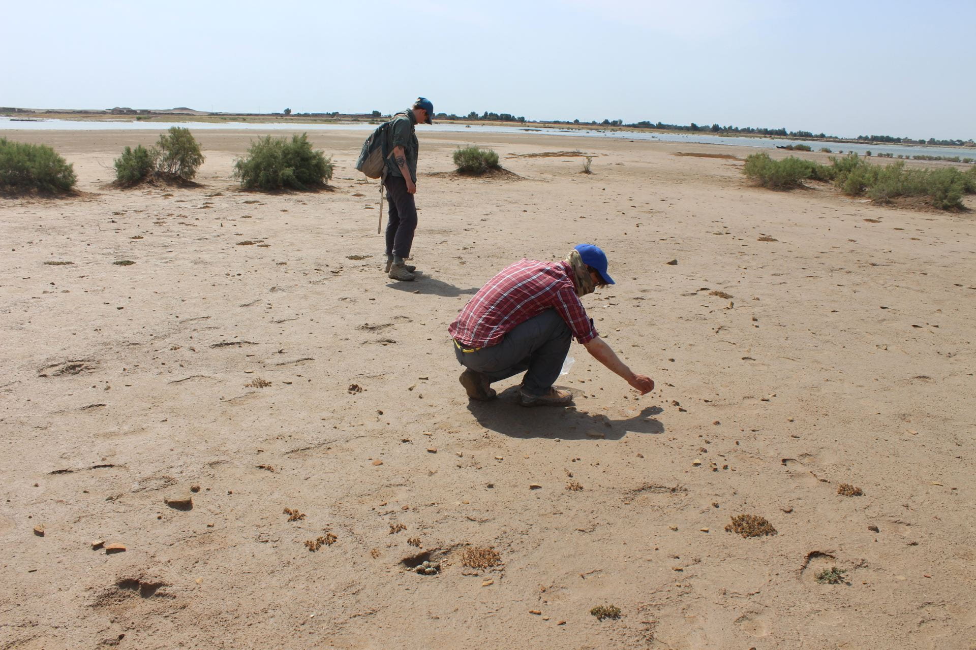 The surface survey of the 2019 season was designed and lead by Prof. Emily Hammer. At ca. 600 hectares, al-Hiba is one of the largest sites in southern Mesopotamia, and there are therefore important questions about the settlement’s occupation density and possible expansion and contraction over time. A survey in the 1980s (Carter 1984) provided an excellent starting point for the survey. That survey was supplemented with more intensive collection methods and by expansion into areas of the site that were previously inaccessible or covered by water in the 1980s. A preliminary assessment of the data from the survey supports the evidence from the 1980s survey that occupation at al-Hiba is dated primarily to the Early Dynastic Period, especially ED III.
The survey also noted extremely large numbers of ceramic circles visible on the surface, most appear to be drains (as proposed by Carter in 1984).
 Prof. Hammer flew a drone (DJI Phantom 4 Pro) to photograph the entire site, and the images will be used to generate a new accurate and detailed topographic map. In addition, the rainy conditions in late March and early April were optimal for the visibility of sub-surface architecture. The drone images revealed large areas of probable houses, visible on the surface.
These areas are especially clear at the northern end, where houses with interior rooms and easily identified streets are visible.
Also visible are possible ancient canals that ran through the settlement. The images also show portions of walls that may surround neighborhoods or the whole site.
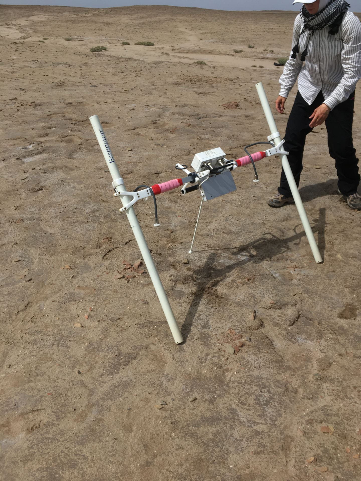
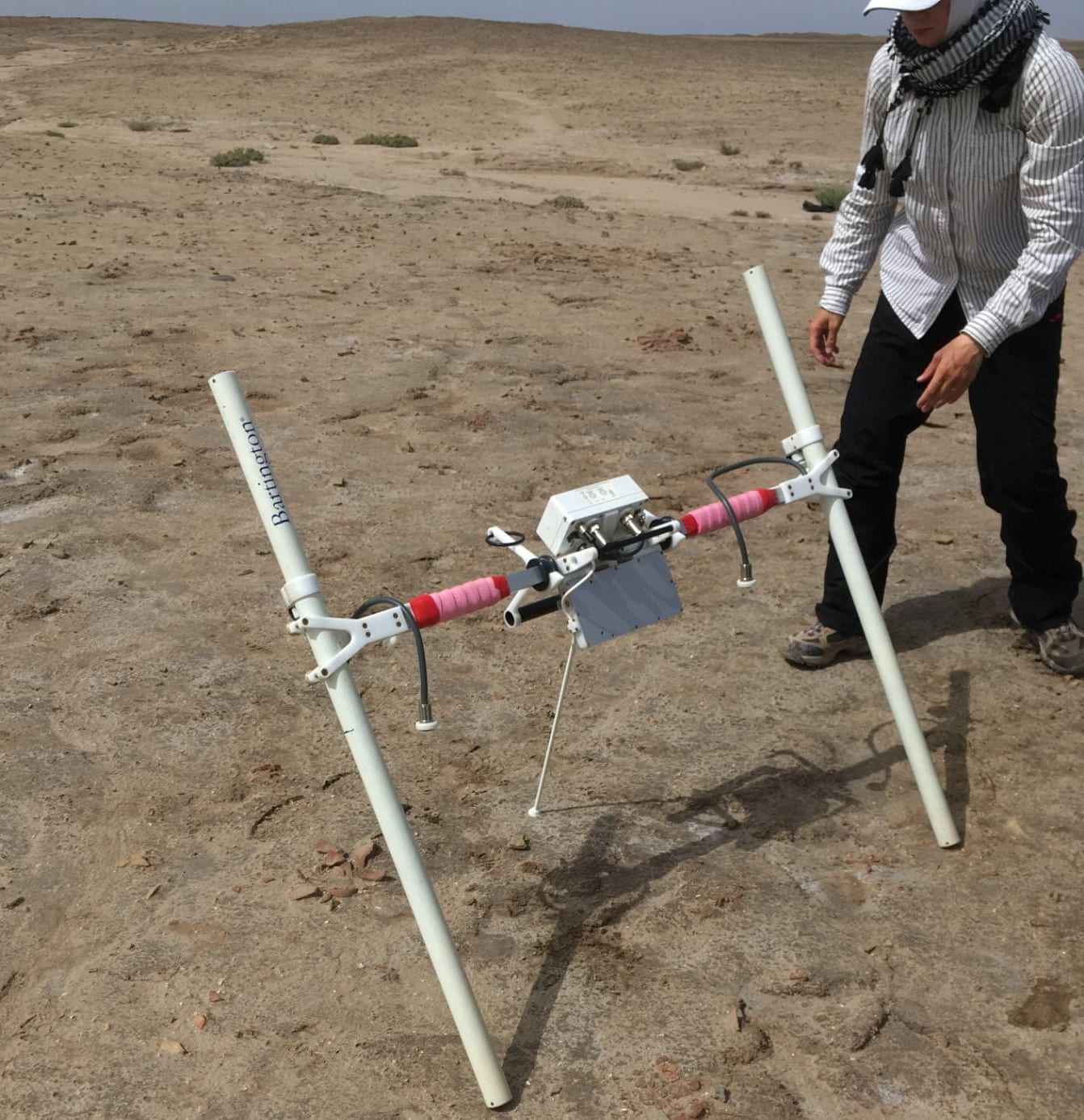 Prof. Hammer supervised the geophysical survey using magnetic radiometry to complement the surface survey and drone photography as methods for assessing al-Hiba’s settlement density and plan. A magnetic radiometer (Bartington Grad 601-2) was used in four different areas of the site, to test whether sub-surface remains could be traced. The results of this survey method were excellent and it will be expanded in future seasons.
Geoarchaeology
Mr. Reed Goodman (PhD candidate, AAMW) supervised a series of eight geologic cores in important points in the immediate area, transecting former levees in the area around Lagash. The goals are to trace the expansion and contraction of the adjacent marsh, to assess the general water levels and hydrology in the past, and to track the development and evolution of ancient environmental conditions that would have supported al-Hiba’s urban growth in the early 3rd millennium BC and ancient hydrology. These cores were achieved with a hand auger and reached depths between 8 to 12 m. The data will undergo extensive geochemical processing, including XRF and grain size analyses. We also recovered material for dating (carbon) and isotopic analyses (shell). R. Liviu Giosan, Woods Hole Oceanographic Institute) is consulting on this important aspect of this part of the Lagash Archaeology Project.
")